File:Gaza-Strip Map.png: Difference between revisions
Jump to navigation
Jump to search

Size of this preview: 631 × 599 pixels. Other resolution: 1,824 × 1,732 pixels.
Original file (1,824 × 1,732 pixels, file size: 1.32 MB, MIME type: image/png)
RedParabola (talk | contribs) m (CAts) |
RedParabola (talk | contribs) mNo edit summary |
||
| Line 1: | Line 1: | ||
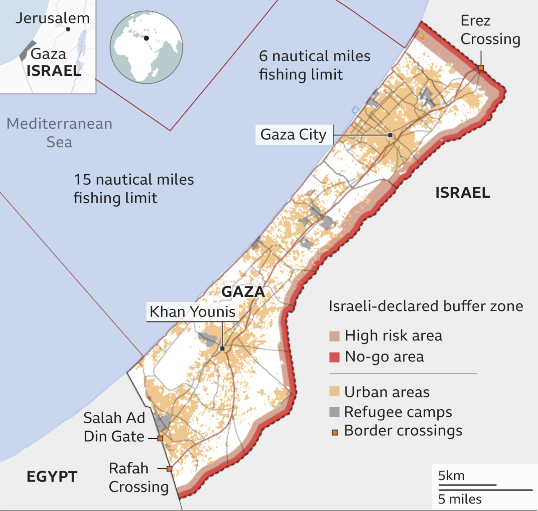
Map of the Gaza Strip. | Map of the locations in the Gaza Strip. | ||
[[Category:Palestine (files)]] | [[Category:Palestine (files)]] | ||
[[Category:Map files]] | [[Category:Map files]] | ||
Latest revision as of 13:52, 2 May 2024
Map of the locations in the Gaza Strip.
File history
Click on a date/time to view the file as it appeared at that time.
| Date/Time | Thumbnail | Dimensions | User | Comment | |
|---|---|---|---|---|---|
| current | 13:44, 2 May 2024 | | 1,824 × 1,732 (1.32 MB) | RedParabola (talk | contribs) |
You cannot overwrite this file.
File usage
The following page uses this file: