Category:Map files
Jump to navigation
Jump to search
Media in category "Map files"
The following 51 files are in this category, out of 51 total.
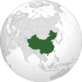 1024px-CHN orthographic.svg.png 250 × 250; 42 KB
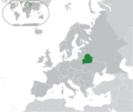 1218px-Europe-Belarus.svg.png 1,218 × 1,024; 309 KB
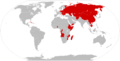 1280px-Marxist countries.svg.png 1,280 × 655; 171 KB
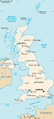 463px-Uk-map.svg.png 463 × 1,023; 130 KB
 480px-CUB orthographic.svg.png 480 × 480; 97 KB
 480px-United Kingdom (orthographic projection).svg.png 480 × 480; 143 KB
 Angola-map-boundaries-cities-locator.jpg 800 × 834; 637 KB
 Baltic-states-map.png 1,460 × 1,792; 2.7 MB
 Bolivia-capital-map.gif 500 × 570; 14 KB
 CHAZ-map.png 1,370 × 856; 1.04 MB
 Clash of Civilizations map.png 1,280 × 650; 193 KB
 Delivering military aid to Ukraine - detailed.svg.png 640 × 325; 75 KB
 DemKampuchea Map.png 217 × 233; 14 KB
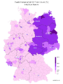 Die Linke 2017 German vote map.png 573 × 767; 211 KB
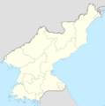 DPRK map.svg.png 1,000 × 1,006; 133 KB
 East Germany 1956-1990.svg.png 250 × 253; 39 KB
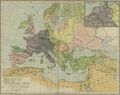 Europe, 814.jpg 2,280 × 1,812; 673 KB
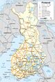 Finland-map.jpg 3,268 × 4,909; 4.38 MB
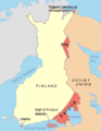 Finnish areas ceded in 1940.png 619 × 800; 26 KB
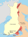 Finnish areas ceded in 1944.png 619 × 800; 65 KB
 German Reich 1942 .png 1,024 × 861; 223 KB
 Gulag Location Map.svg.png 600 × 424; 144 KB
 History of NATO enlargement.svg.png 1,004 × 768; 288 KB
 Israel Location Map.svg.png 250 × 250; 25 KB
 Italian Colonial Empire (orthographic projection).svg.png 500 × 499; 127 KB
 Italian Social Republic within Europe 1943.svg.png 500 × 507; 101 KB
 Italy-1914.jpg 880 × 880; 264 KB
 Map of participants in World War II.png 1,480 × 625; 50 KB
 Map of the Nordic Countries.png 1,386 × 1,732; 3.8 MB
 Map of the PSR Albania.png 250 × 253; 39 KB
 Map-burkina-faso.png 1,275 × 1,275; 183 KB
 Map-iranIslamicRepublic.png 1,275 × 1,275; 237 KB
 Nepalgrey.png 1,036 × 600; 61 KB
 NZL orthographic NaturalEarth.svg.png 1,024 × 1,024; 276 KB
 October 2023 Gaza−Israel conflict.png 1,183 × 1,024; 2.11 MB
 Orthographic Map of Poland.png 900 × 900; 313 KB
 Outre-mer en.png 1,480 × 740; 54 KB
 Partitions of Poland.png 1,024 × 842; 436 KB
 Poland in European Union.png 1,051 × 899; 362 KB
 Russian Empire.png 1,082 × 1,082; 334 KB
 Second world war europe 1941-1942 .png 1,090 × 1,000; 216 KB
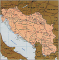 SFRY map.png 1,158 × 1,164; 3.53 MB
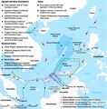 South China Sea Claims and Boundary Agreements 2012.jpg 853 × 864; 184 KB
 Soviet Union Map.png 1,356 × 928; 63 KB
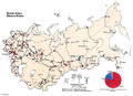 SovietElectricPower.png 1,395 × 1,011; 1,014 KB
 SovietRailRoads.png 1,200 × 816; 445 KB
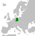
 SR Romania.svg.png 500 × 507; 95 KB
 Suomen-kansantasavalta.png 1,392 × 1,731; 96 KB
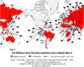 US military and cia interventions since WW2 killing hope.png 855 × 676; 66 KB
 USA orthographic.svg.png 440 × 440; 110 KB


.svg.png)
.svg.png)


.svg.png)


