File:Baltic-states-map.png
Jump to navigation
Jump to search

Size of this preview: 488 × 599 pixels. Other resolution: 1,460 × 1,792 pixels.
Original file (1,460 × 1,792 pixels, file size: 2.7 MB, MIME type: image/png)
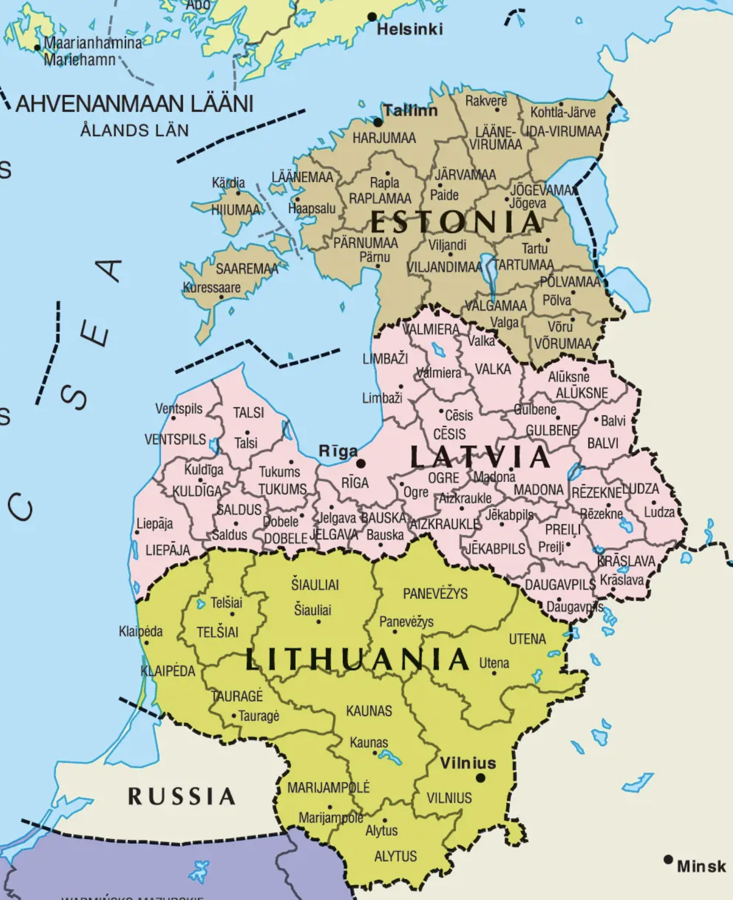
Map of the Baltic States.
File history
Click on a date/time to view the file as it appeared at that time.
| Date/Time | Thumbnail | Dimensions | User | Comment | |
|---|---|---|---|---|---|
| current | 21:25, 26 April 2024 | | 1,460 × 1,792 (2.7 MB) | RedParabola (talk | contribs) |
You cannot overwrite this file.
File usage
The following page uses this file: