File:SFRY map.png: Difference between revisions
Jump to navigation
Jump to search
RedParabola (talk | contribs) No edit summary |
RedParabola (talk | contribs) m (Cats) |
||
| Line 2: | Line 2: | ||
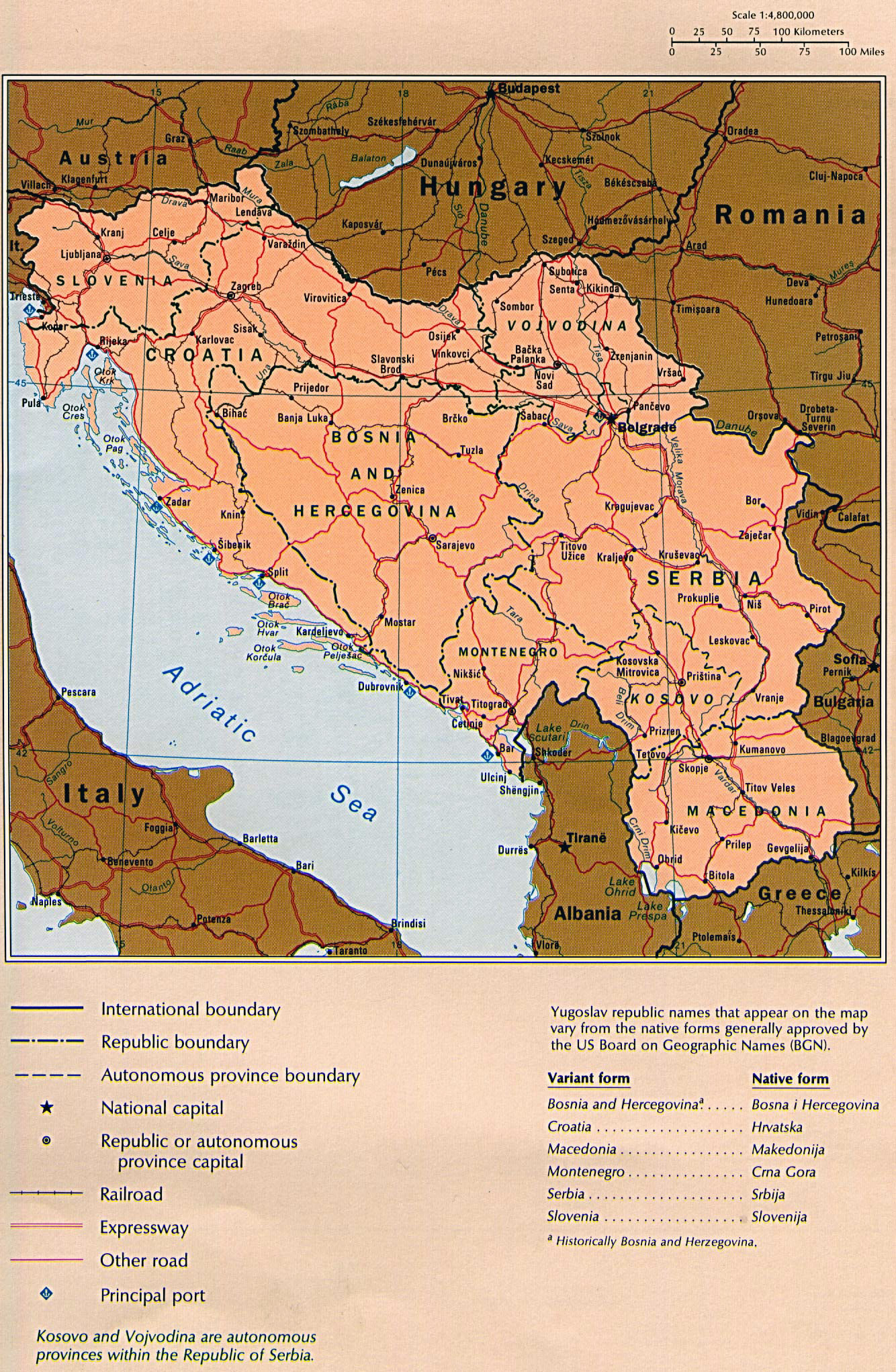
Cropped from the [https://www.mapas-del-mundo.net/mapas/europa/yugoslavia/grande-detallado-mapa-politico-de-yugoslavia-con-carreteras-ferrocarriles-y-ciudades-importantes.jpg original version]. | Cropped from the [https://www.mapas-del-mundo.net/mapas/europa/yugoslavia/grande-detallado-mapa-politico-de-yugoslavia-con-carreteras-ferrocarriles-y-ciudades-importantes.jpg original version]. | ||
[[Category:Map files]] | |||
[[Category:Yugoslavia (files)]] | |||
Latest revision as of 22:45, 18 April 2024
Map of the former Socialist Federal Republic of Yugoslavia.
Cropped from the original version.
File history
Click on a date/time to view the file as it appeared at that time.
| Date/Time | Thumbnail | Dimensions | User | Comment | |
|---|---|---|---|---|---|
| current | 22:36, 18 April 2024 |  | 1,158 × 1,164 (3.53 MB) | RedParabola (talk | contribs) |
You cannot overwrite this file.
File usage
The following page uses this file: